The tropics have been extremely active as of late, and this pattern is not predicted to change anytime soon.
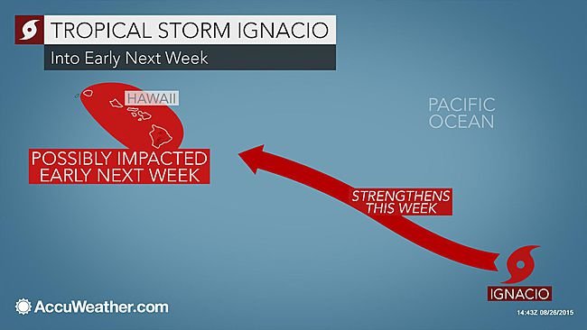
A new tropical storm, Ignacio, has formed in the eastern Pacific as of Tuesday afternoon. This system is expected to follow a west-northwest path over the rest of the week. As of right now, this system doesn’t pose any immediate threat to anybody on the island, but it could bring some impacts to Hawaii farther down the road. It is still too early determine the exact track and intensity of this system, as the conditions are always subject to change.
The wind shear will more than likely remain low over the next couple of days, and when this combines with warm sea surface temperatures, some strengthening should happen. Wind shear is a very important factor, and can also be a hindrance to formation as well. When the wind shear is strong, it can disrupt the system and ultimately cause it to dissipate and disorganize. When the wind shear is low, it can lead to a tropical system beginning to gather more intensity.
The conditions through the end of the week will be conducive to system strengthening, so that means that Ignacio could reach hurricane status by next week. But, ultimately the exact track and whether or not it will pass over Hawaii will depend on the overall strength of the system, and how it interacts with a dome of high pressure that is present over the central Pacific.
If Ignacio does pass close to Hawaii, residents can expect rough surf and strong rip currents along the east-facing shores of the Hawaiian Islands. There will also be an uptick in moisture, which can enhance showers and lead to localized flooding in some areas.
If you have interests in these areas, you will want to make sure that you’re checking back with your local weather authority over the course of the next week. Ignacio is not the only system to be worried about. While this system continues to churn in the eastern Pacific, there are still other systems that are bringing some strong rain showers to the Hawaiian Islands.

Both Kilo and Loke are helping fuel some rain over the Hawaiian Islands, which is leading to high rainfall amounts and even flooding in some local areas.
Honolulu recorded about 3.60 inches of rain on Monday, which is more than 6 times what they normally receive on a monthly basis. The heavy rain that has been present lately has been causing numerous flooding issues, as well as sewer problems and washed-out roadways.
A press release from the City and County of Honolulu revealed that several sanitary sewer overflows occurred due to heavy consistent rain, which in turn caused beach closures and a Brown Water Advisory to be issued.
Even though these systems will not directly impact the islands, and will continue to move away as we reach the weekend, they will still travel close enough to bring the risk of additional flooding from heavy showers, and will also produce rough surf and rip currents along the south-facing shores.
The typical trade winds that were disrupted due to these two systems will return back to normal towards the end of the week, which will help diminish the threat for heavy showers. Rainfall amounts for the month of August have been well above normal across the whole island of Hawaii. This is largely attributed to the fact that there has been an increase in tropical activity, as well as a strong influence from El Nino.
It is important to stay updated on the weather in your area, so check with your local weather authority, The Weather Channel, or AccuWeather for ongoing updates on Ignacio, Kilo, and Loke.


